Dec
10
2008
 Cement Creek Road (Silverton, CO)
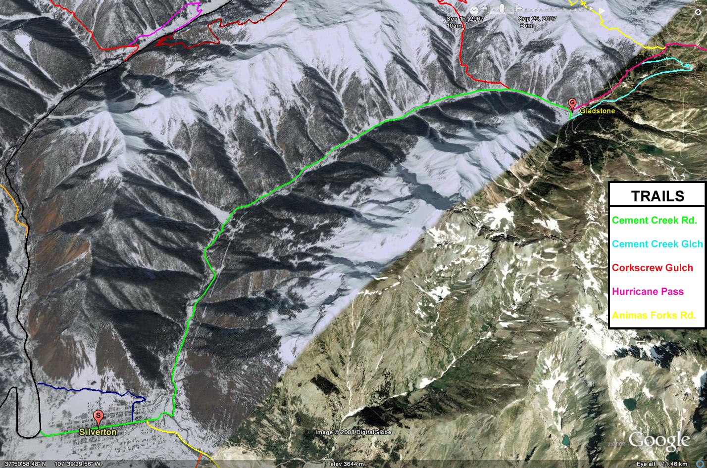
Cement Creek Road is a wide graded road that starts in Silverton and makes it’s way to Gladstone. While this road is easy and can be traversed by any passenger vehicle, it offers great scenery and passes by a number of old mining sites. This road also leads to a number of other trails in the area including Prospect Gulch, Minnehaha Basin, Cement Creek Gulch and Hurricane Pass.
Please feel free to leave your comments and post your pictures from Cement Creek Road below.
 Cement Creek Road KML Track
(Right click and ‘Save Target As’)
Open file above in Google Earth.
Comments Off on Cement Creek Road | posted in Trails
Dec
9
2008
 Thompson Cutoff Road (Thompson Springs, UT)
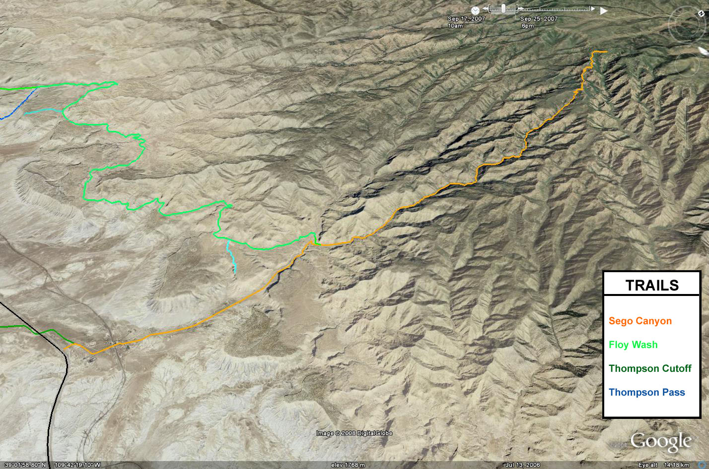
The Thompson Cutoff Road is an alternate route to reach Thompson Springs from Moab by getting off the pavement and following an easy gravel road. This road can also be used to bypass some pavement on your way to Moab from the east as well.
This is an easy road that is pretty short and it won’t take much longer than staying on the highways. This road also leads to the Yellow Cat Flat area and the alternate entrance to Arches National Park that heads through Salt Valley.
Please feel free to leave your comments and post your pictures from Thompson Cutoff Road below.
Thompson Cutoff Road KML Track
(Right click and ‘Save Target As’)
Open file above in Google Earth.
Comments Off on Thompson Cutoff Road | posted in Trails
Dec
4
2008
 Sego Canyon (Thompson Springs, UT)
Sego Canyon is as easy scenic drive that starts out of Thompson Springs north of Moab, and heads into the Book Cliffs before it dead ends at a gate at the Uintah and Ouray Indian Reservation. While the scenery along the trail is great, there are a few highlights near the beginning of Sego Canyon that are a short trip from Interstate 70 that make for a great short side trip.
The first of these highlights is the rock art located near the head of the canyon. There are a few petroglyph and pictograph panels just off the road that depict a few different styles of rock art including Barrier Style, Fremont Style and Historic Ute. After checking out the rock art, you will continue up the canyon about a mile and a half before coming to the ghost town of Sego. Sego was a coal mining town and left are the remains of two large structures. One is the old wooden saloon/boarding house and the other is a large stone building that was the general store.
If you are in a hurry, you can turn around here and head back to the highway. However, if you like exploring new places and checking out great scenery you can still continue up Sego Canyon for another 10 miles. At the start, you are following the bottom of the wash, and near the end of the trail you will climb out of the canyon on some easy switchbacks. Before reaching the gate at the end of the road, you will pass some areas that would make good campsites. Once at the end, you will have to return the way that you came, because you cannot enter the Uintah and Ouray Indian Reservation.
Please feel free to leave your comments and post your pictures from Sego Canyon below.
Sego Canyon KML Track
(Right click and ‘Save Target As’)
Open file above in Google Earth.
1 comment | posted in Trails
Nov
19
2008
 Gateway – Castleton Road (Gateway, CO)
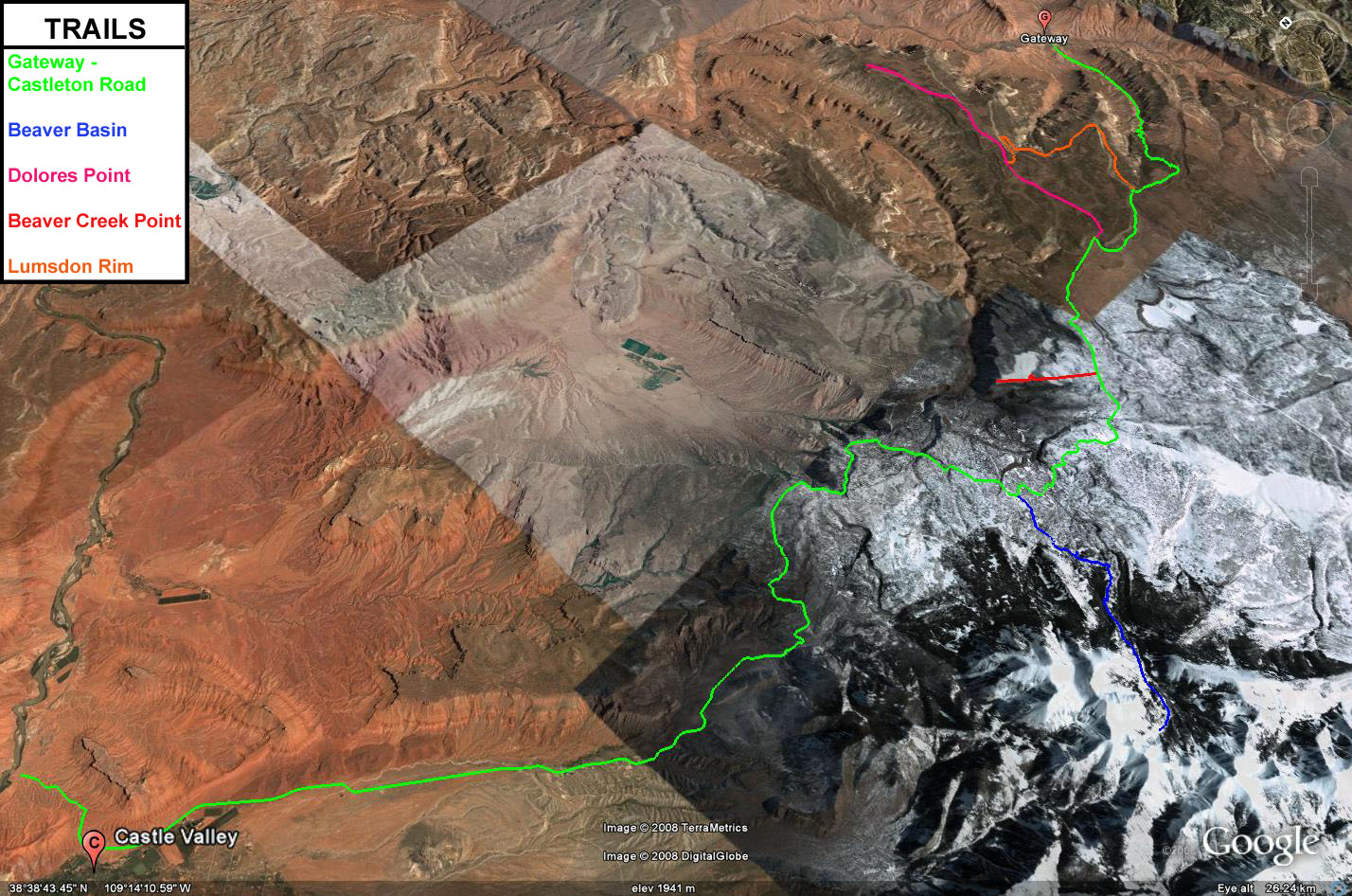
The Gateway – Castleton Road is an easy road that starts off in Gateway, Colorado and ends in Castleton, Utah near the La Sal Mountain Loop Road which you can take in either direction to get to Moab. This is an alternate backcountry route from Colorado to Moab that keeps you off the pavement and off of I-70. When the route is not blocked by snow in the winter, it is also my preferred route when I head to Moab from Grand Junction.
This road starts out near the Dolores River and Gateway Canyons Resort in Gateway and takes you through John Brown Canyon. This area of western Colorado is a historic uranium mining area, and now there is currently a new uranium mine that has opened up again. After leaving Colorado and entering Utah you travel through the lower foothills of the La Sal Mountains and are greeted with great views of Castle Valley and Fisher Valley.
There are a number of roads and trails all along the Gateway – Castleton Road that you can spend much time exploring. Some of these trails include Beaver Basin, Polar Mesa, Fisher Mesa, Adobe Mesa, Dolores Point and Taylor Flat. I have spent a lot of time in this area and there are still a lot of places I haven’t been to yet.
Please feel free to leave your comments and post your pictures from the Gateway – Castleton Road below.
Gateway – Castleton Road KML Track
(Right click and ‘Save Target As’)
Open file above in Google Earth.
10 comments | posted in Trails
Nov
18
2008
 Hancock Pass (Buena Vista, CO)
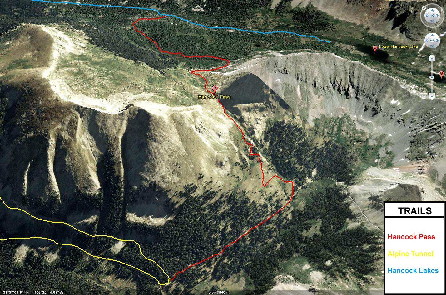
Hancock Pass takes off from the Hancock Lakes trail and crosses the Continental Divide at an elevation of 12,140 feet and connects to both Tomichi Pass and the Alpine Tunnel Road. The trail gets a bit rocky and bumpy but can be driven in a stock high-clearance 4×4 vehicle. If you start out on Hancock Lakes Road, this trail takes off from the right side shortly after passing through the Hancock townsite.
The trail is rocky as it wanders through a forest before it turns into a rocky shelf road where it climbs up to the pass. Before reaching the pass, there are some great views below. After crossing Hancock Pass, the views down into Brittle Silver Basin are awesome and is a great place for taking some photos. After following the trail down into the basin it soon meets up with Tomichi Pass and the Alpine Tunnel Road.
This trail combined with Hancock Lakes Road, Alpine Tunnel Road, Cumberland Pass and Tincup Pass makes a great loop for exploring this area of the Sawatch Range with a lot of mining history to see and explore. However, if you are looking for a quick way back to the pavement after heading over Hancock Pass, you can head over Tomichi Pass to get back to US 50.
Please feel free to leave your comments and post your pictures from Hancock Pass below.
Hancock Pass KML Track
(Right click and ‘Save Target As’)
Open file above in Google Earth.
Comments Off on Hancock Pass | posted in Trails