The Official Grand Loop 4×4 Trail Guide
The Grand Loop 4×4 Trail
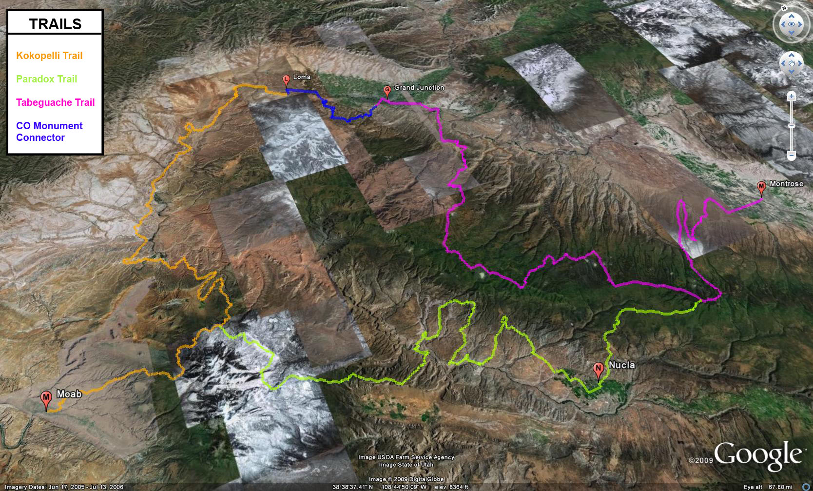
The Grand Loop 4×4 Trail is a 454 mile route that covers remote terrain in Western Colorado and Eastern Utah. This trail combines the Kokopelli, Tabeguache and Paradox 4×4 trails to form one large loop. While there are some short sections of driving on the pavement, much of this route is off of the pavement on backroads, and includes some rough trails, too.
This loop is usually started at the Kokopelli trailhead in Loma, CO and is driven in a counter-clockwise direction, but it can be driven in either direction. Not only is there the opportunity to get into the backcountry for a number of days, but there are enough towns around the loop that a stop for fuel or food is not too far out of your way. To enjoy each of the trails in the loop, I would suggest at least two days each, though each trail can be driven in one long day, if you push it. There are plenty of campsites located along each trail as they travel through mostly National Forest and BLM land.
For specific information about each trail in the Grand Loop, follow the links below for each section.
Just one note about this loop is that it is still a work in progress to perfect it. The route as it currenly is routed works great, however, I feel there are some sections that might be changed in the future to follow these trails as closely as possible. As I do more research and scouting of the trails, it is possible for these routes to change a little. So before you head out to check them out on your own, make sure to check each trail’s webpage for the latest updates.
Kokopelli 4×4 Trail Information (140 miles)
Loma to Moab
Paradox 4×4 Trail Information (127 miles)
Moab to Montrose
Tabeguche 4×4 Trail Information (154 miles)
Montrose to Grand Junction
Colorado National Monument Connector (33 miles)
Grand Junction to Loma
If you have any questions, suggestions or comments about The Grand Loop 4×4 Trail, please feel free to post them below.
This page was last updated on: 06/16/2009