Nov
18
2012
Sunday, October 28, 2012
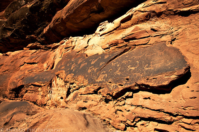
It was one of those days that I just needed to get out hiking and exploring by myself, so that’s what I set out to do. Last year around Christmas I had planned to hike along the Dolores River near Bedrock but got a severe headache on the drive there and had to turn around and head back home. I hadn’t made it back that way yet, so I thought it would be a good time to try again. After leaving home and driving through Unaweep Canyon to Gateway, I then followed the Dolores River to Paradox Valley and turned off at the dead-end road by the Bedrock store to the boat ramp. One day soon I want to float the Dolores River from the Big Gypsum Valley to Bedrock and wanted to check out the takeout. After leaving the boat ramp the road I was on got a bit rougher, but I managed to drive a little ways further until I reached and area that was completely washed out. I parked my Jeep there and continued along the river on foot. The hike was easy and for the most part since it followed an old road that hadn’t been drivable in quite some time. After a few miles I reached a few boulders with petroglyphs on them that I had hoped to find.
On the back of the main boulder there were a few faint bear paw petroglyphs next to some nice lichen.
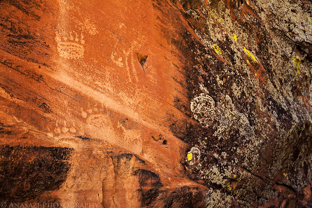
Bear Paws by IntrepidXJ, on Flickr
The front of the main boulder had a bunch of faded petroglyphs that have been vandalized over the years.
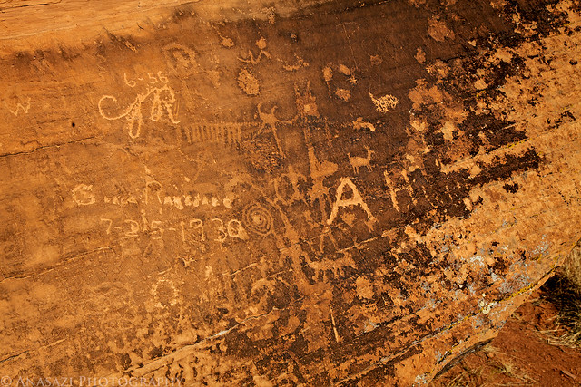
Petroglyphs & Graffiti by IntrepidXJ, on Flickr
Triangle body with big hands.
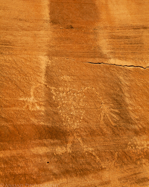
Long Arms by IntrepidXJ, on Flickr
Two more paw prints.
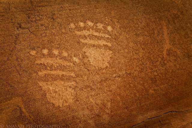
Prints by IntrepidXJ, on Flickr
Comments Off on Along the Dolores | posted in Adventures, Anasazi, Dinosaur Tracks, Hiking, Photography, Rock Art, Trip Reports, Ute
Oct
26
2012
Arizona Strip & Southern Utah Wanderings | Day 4
Tuesday, October 9, 2012
Since there weren’t really any good places nearby to photograph sunrise, we slept in a little later on Tuesday morning. After a little breakfast we packed up camp and took the rough Jeep road to it’s end where we would start our hike. Our destination for today would be to the top of Flag Point in the Vermilion Cliffs of the Grand Staircase. Jared and I had wanted to try this hike last year, but were unable to squeeze it in. From what I understand, most people that have made this trek hike up from the base of the cliff and are able to find a way up, however we thought that we would try to hike from the backside. It was probably a longer hike, but it involved less steep climbing.
The view towards Kanab from the top of Flag Point.
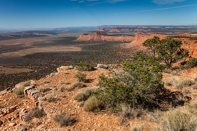
Flag Point View by IntrepidXJ, on Flickr
After visiting the point we started hiking along the rim in search of a dinosaur track site.
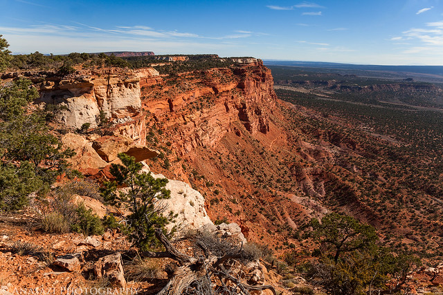
Rim Hiking by IntrepidXJ, on Flickr
Jared taking a photo looking back at Flag Point.
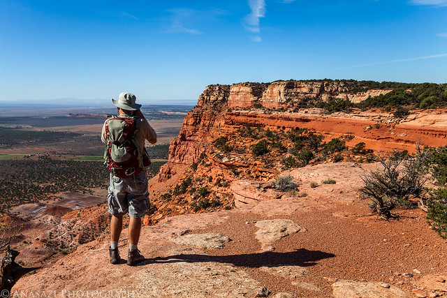
Leaving Flag Point by IntrepidXJ, on Flickr
Comments Off on Flag Point | posted in Adventures, Anasazi, Camping, Dinosaur Tracks, Hiking, National Parks & Monuments, Photography, Rock Art, Trip Reports
Mar
21
2012
Saturday, March 3, 2012
After spending the last two weeks in the Chicago area, and not having been to Moab in almost a month (February is one of my favorite times to hike around Moab since the weather is usually nice and there aren’t any crowds yet), it was time for me to get back out into the desert for a long hike alone. I left home in the morning without any particular destination in mind, but by the time I reached Moab I had decided to hike out onto Amasa Back following the Cliffhanger Jeep Trail. This is actually one of the few Jeep trails around Moab that I have not driven before, so it was nice to finally be able to check it out.
A short way into the hike I found a small and faded petroglyph panel.
Cliffhanger Petroglyphs by IntrepidXJ, on Flickr
Before continuing to Amasa Back I decided to stop an revisit the amazing Owl Petroglyph Panel nearby.
Owl Panel by IntrepidXJ, on Flickr
I also searched the area to find these very interesting petroglyphs that I had missed before.

Lines & Sheep by IntrepidXJ, on Flickr
Comments Off on Amasa Back | posted in Adventures, Dinosaur Tracks, Hiking, Photography, Rock Art, Trip Reports
Oct
19
2011
Arizona Strip & Southern Utah Wanderings | Day 2
Sunday, October 2, 2011
After an awesome night camping under the stars in perfect weather near Little Black Mountain, we were up early, had a little breakfast and were soon on our way back into Utah. Our ultimate destination for the day would be Toroweap on the North Rim of the Grand Canyon, but we would have a lot of exploring to do on our way there.
After entering Utah again, we quickly found ourselves in Warner Valley. As we headed east, we took the short detour to Fort Pearce which is located along the old Honeymoon Trail.
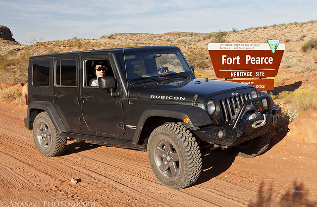
Fort Pearce Heritage Site by IntrepidXJ, on Flickr
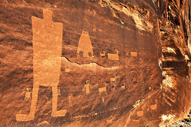
Of course, our first objective at the site was to find the petroglyphs located near the fort. They were easy to find and the area offered a nice view.
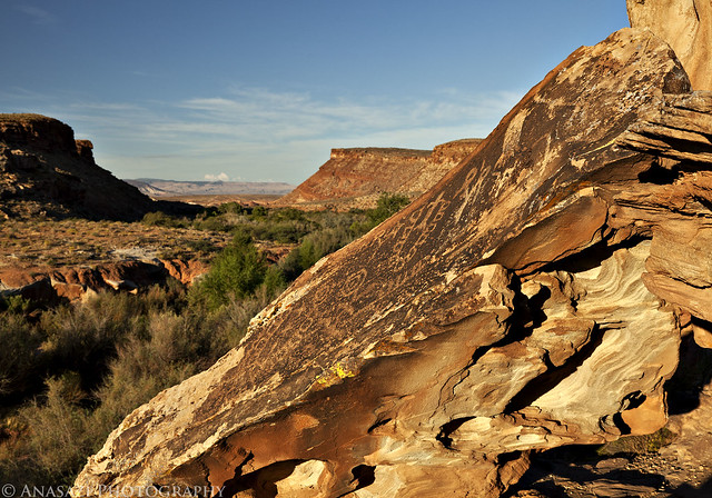
Fort Pearce Petroglyphs by IntrepidXJ, on Flickr
A closer look at the petroglyphs on the slanted boulder.
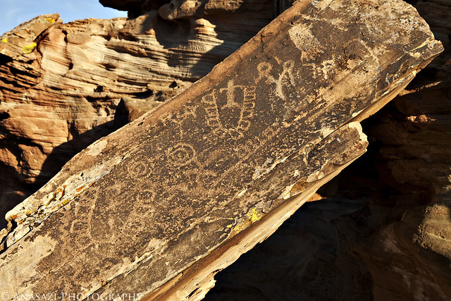
Fort Pearce Boulder by IntrepidXJ, on Flickr
Comments Off on Straddling the Border to Toroweap | posted in Adventures, Anasazi, Dinosaur Tracks, Hiking, History, National Parks & Monuments, Photography, Rock Art, Trip Reports
Aug
30
2010
August 21-22, 2010
Since Amanda had to work this weekend and I didn’t want to travel too far from home, I headed out to explore the La Sal Mountains as part of my Laccolith Tour this year. I have been to the La Sals a number of times before, so I have driven most of the main trails, so my goal this trip was to explore some new ones. From my house I headed up Unaweep Canyon to Gateway and then took John Brown Canyon up into the foothills of the La Sals.
Before getting started on my first trail, I stopped along the Castleton-Gateway Road and found some dinosaur footprints that I knew were in the area.
The best print
One filled with some dirt with the other one in the background
Overlook near the dino prints
My next destination was to check out the trail on Fisher Mesa. This one had been on my to-do list for a while…..
Along the trail I stopped and made a short hike to a geocache that was hidden near an old cabin on the rim of Fisher Mesa
Great view from the old cabin
Continue reading
Comments Off on Laccolith Tour | La Sal Mountains | posted in Adventures, Dinosaur Tracks, Geocaching, Hiking, Trip Reports, Wheeling Pictures


