Apr
26
2010
Charles Wells just released his Third Edition of the Colorado 4×4 guidebook on Friday, and my copy just showed up in the mail 🙂 The quality of this book seems to be much higher than the previous versions, including the new hidden spiral binding. There should be at least a few new trails in here that I haven’t been on yet 😉
You can find more info on the book here. It’s on sale this week only for 20% off.
Comments Off on Guide to Colorado Backroads & 4-Wheel-Drive Trails | posted in Books, Maps
Jun
16
2009
If you would like to complete The Grand Loop 4×4 Trail, you will need to connect the end of Tabeguache 4×4 Trail with the Kokopelli trailhead in Loma. I would suggest continuing on down Monument Road and entering the Colorado National Monument. Here you can follow the main road through the park and exit near Fruita.
Even though this section is all paved, it is a very scenic drive with a number of great overlooks and hiking trails. You will need to pay admission to enter the park.
This is the preferred route to connect the Tabeguache and the Kokopelli to complete The Grand Loop 4×4 Trail.
GPS Tracks for the Colorado National Monument Connector
 Google Earth Track (Version 1)
 GPX Track (Version 1)
If you have any questions, suggestions or comments about the Colorado National Monument Connector, please feel free to post them below.
This page was last updated on: 12/19/2009
1 comment | posted in GPS, Maps
Sep
30
2008
Here’s a map I made in Google Earth with all my tracks in the San Juans up until this point. Hopefully next year I can add even more GPS tracks to the map 😉 Click the map for a larger image.
Comments Off on San Juan Mountains Trail Map 2008 | posted in Google Earth, GPS, Maps
Sep
23
2008
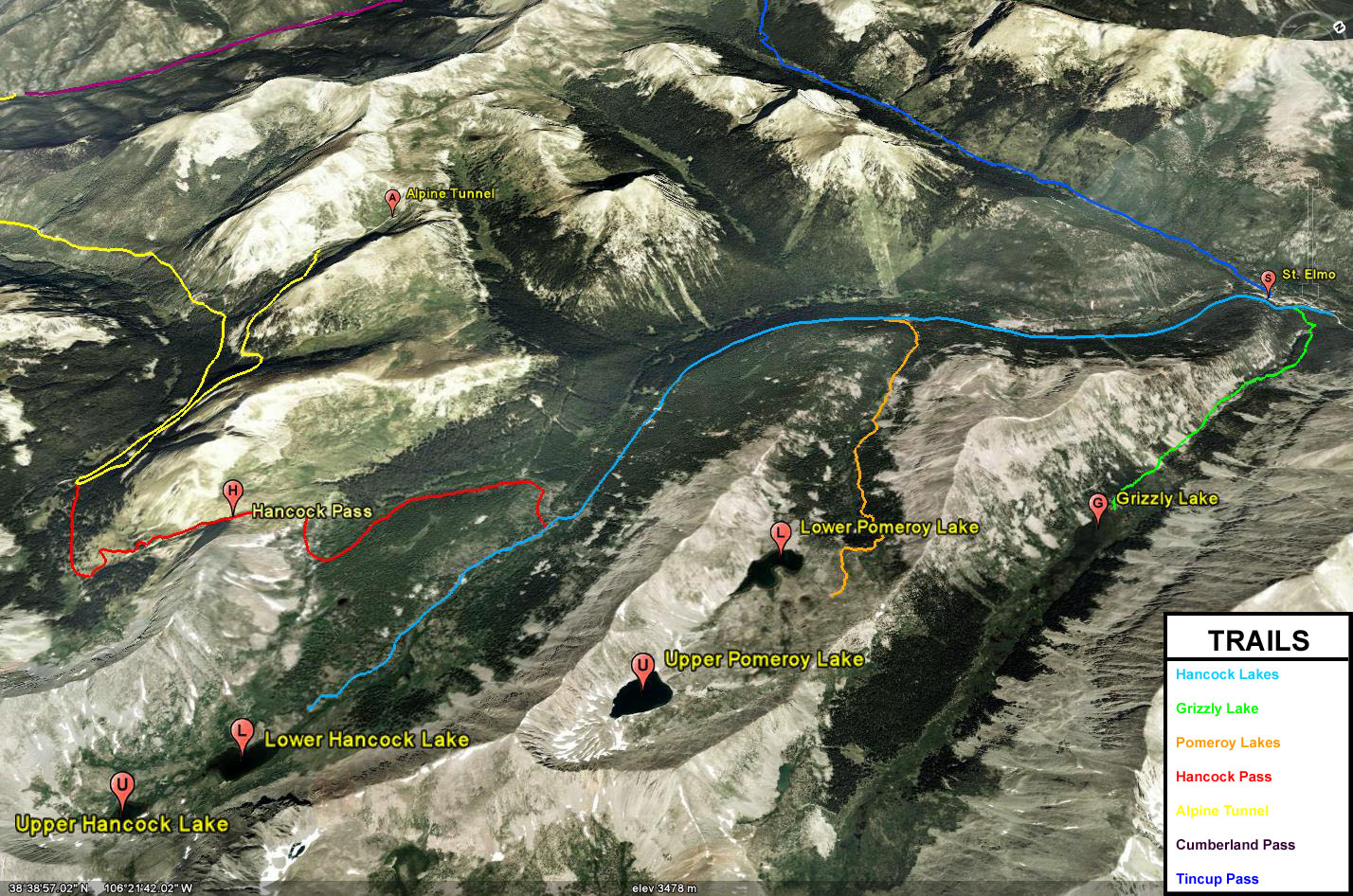
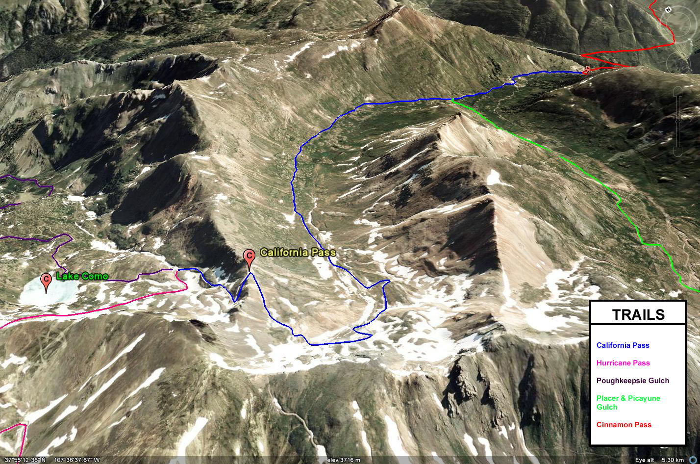
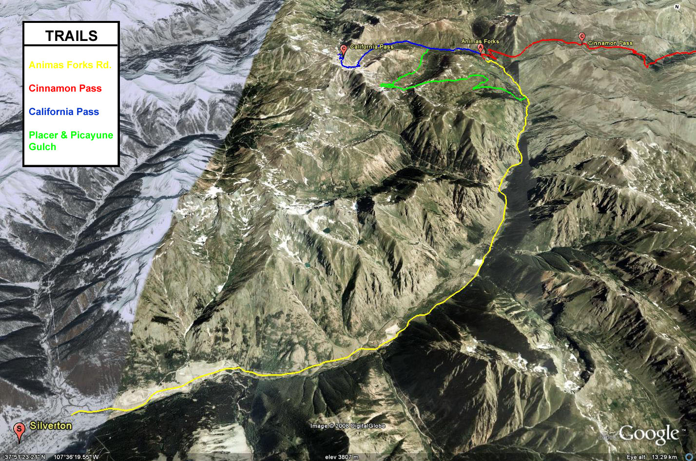
I have not been very happy with the maps I have been using for my trail writeups, so I spent some time working on better maps with more waypoints added this evening. I’ll be working on updating the trail writeups over the next few weeks/months as well as posting better Google Earth KML files.
Here’s a few of the maps I have completed this evening 🙂
Click on the smaller maps above for a larger version.
Comments Off on New Trail Maps | posted in Google Earth, Maps, Website
Sep
19
2008
When I write-up my weekend trips and trails on my website here, I like to use the mountain range name to help identify the area that I am in. While I know where these ranges are located, it has been brought to my attention that not everyone does.
Because of that, I have found a map of Colorado that shows where all of the major mountain ranges are located. Hopefully this will help out your explorations in Colorado or when you are following along with mine 🙂
I may go though in the future and add some more features to this map, but this one should suffice for now.
Comments Off on Colorado Mountain Ranges | posted in Maps, Personal