Sep
8
2008
Here’s a map I made in Google Earth of the trails that we ran on Saturday. In the order that we ran them…
Pink: Poughkeepsie Gulch
Blue: Hurricane Pass
Yellow: Corkscrew Pass
Orange: Brown Mountain
Dark Red: US Basin & Browns Gulch
Green: Porphyry Basin
Comments Off on San Juans Day Trip Trail Map | posted in Google Earth, GPS, Maps
Sep
3
2008
Here’s a map of all the trails I ran in the Elk Mountains last weekend. It includes these trails (from top to bottom for duplicate colors):
Green: Lead King Basin
Blue: Crystal City
Yellow: Schofield Pass
Orange: Rustler Gulch
Red: Gothic Road
Green: Paradise Basin
Purple: Washington Gulch
Yellow: Gunsight Pass
Light Blue: Kebler Pass
If you would like a GPS track of these trails, check out each individual trail writeup on my site 🙂
Comments Off on Elk Mountains Trail Map | posted in Google Earth, GPS, Maps
Jun
30
2008
Here’s a map of the track we took yesterday on Grand Mesa. You can see all the switchbacks on Lands End Road.
If you want the GPX file, you can download it here
Comments Off on Grand Mesa Map and GPX file | posted in Maps
Jun
29
2008
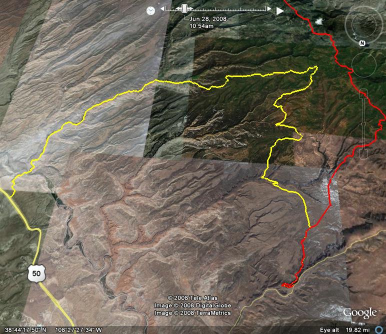
Here’s a map from from yesterday’s trip starting in Jacks Canyon to Divide Road and then headed to Dominguez Canyon, Dominguez Ridge, Brushy Ridge, Palmer Gulch and finally Escalante Canyon. The yellow route is the way we went yesterday and the red route is Divide Road that I travelled last year.
The GPX file for yesterday’s trip can be found here.
Comments Off on Uncompahgre Map and GPX file | posted in Maps
Apr
30
2008
While in the San Rafael Swell last weekend, I used Amanda’s Garmin eTrex Venture HC to keep GPS tracks from both days. Here’s the map from Google Earth.
I’ll also attach the KML file here if you would like to play around with it.
Comments Off on Map from last weekend in The Swell | posted in Google Earth, GPS, Maps