Mar
28
2011
Saturday, March 26, 2011
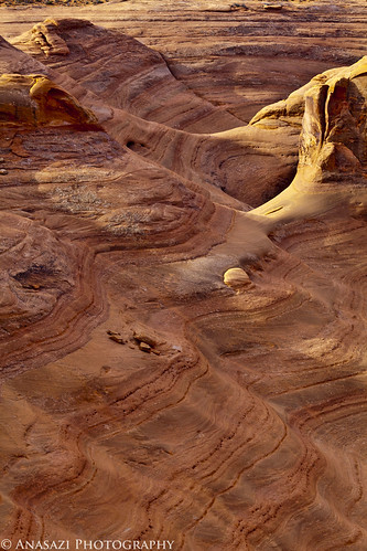
On Saturday, Jackson and I headed into Utah so that I could check on a geocache I hid last summer. After checking on the cache, we hiked around the rim of the canyon nearby.
Wavy Sandstone
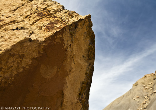
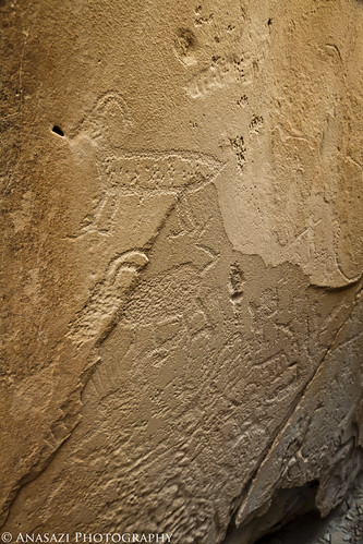
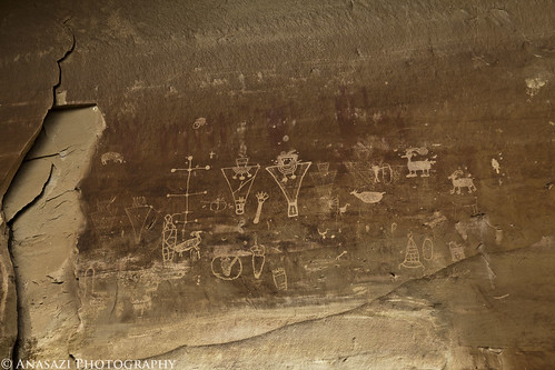
After some more hiking around and on Jug Rock, we headed north to the Book Cliffs in search of some petroglyphs….specifically The Butterfly, or bat, petroglyph. I had an idea on where it was located, but not an exact location. We searched the area for a little bit and managed to find it.
The Butterfly
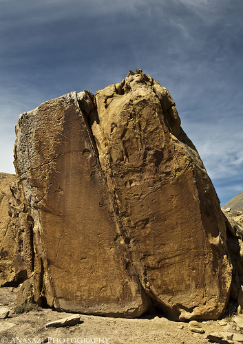
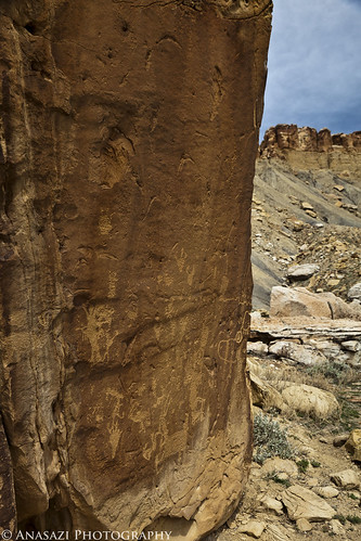
After finding The Butterfly, we searched the nearby boulders and found a bunch of other petroglyphs.
Book Cliff Boulder
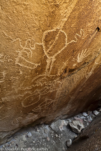
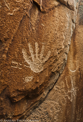
There was a small crack between two large boulders that I squeezed into, and inside there were a bunch of petroglyphs…
In the Crack
Sheep in the Crack
Another Hand
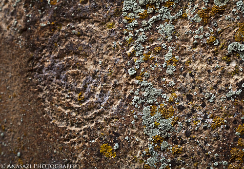
Lichen & Faint Spiral
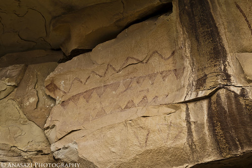
Another look at a boulder with many petroglyphs on it….
Book Cliff Boulder 2
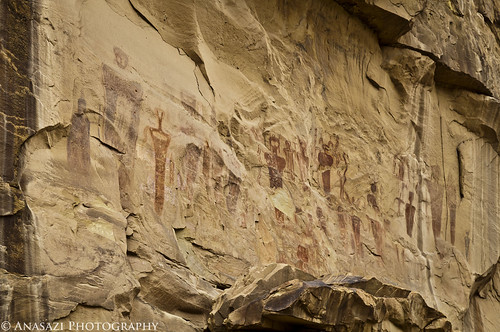
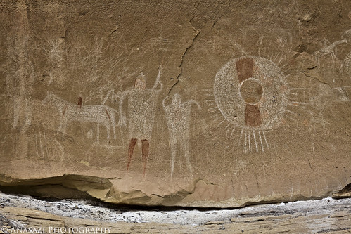
When we were done searching the area I took Jackson over to the Sego Rock Art Site, since he had never been there. I’ve been here numerous times before, but not since I got my new camera, so I took a few photos while we were there.
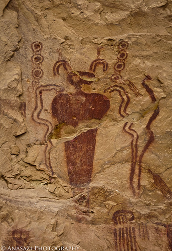
Sego Canyon Pictographs
Sego Snake Man
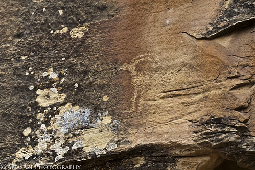
We searched the area and managed to find a petroglyph of a sheep I had not seen before.
Sego Sheep
Sego Snake
Fremont petroglyphs over faint Barrier Canyon Style pictographs. Look closely above the petroglyphs…
Fremont Over Barrier
Sego Ute Shield
We had plans to find some more pictographs, and I headed to the area they were supposed to be in…..unfortunately, I took the long way and by the time we got there we had run out of time and had to head home. I know I will be returning to the Book Cliffs in search of more rock art this year 🙂
3 comments | posted in Adventures, Barrier Canyon Style, Fremont, Geocaching, Photography, Rock Art, Trip Reports, Ute
Aug
30
2010
August 21-22, 2010
Since Amanda had to work this weekend and I didn’t want to travel too far from home, I headed out to explore the La Sal Mountains as part of my Laccolith Tour this year. I have been to the La Sals a number of times before, so I have driven most of the main trails, so my goal this trip was to explore some new ones. From my house I headed up Unaweep Canyon to Gateway and then took John Brown Canyon up into the foothills of the La Sals.
Before getting started on my first trail, I stopped along the Castleton-Gateway Road and found some dinosaur footprints that I knew were in the area.
The best print
One filled with some dirt with the other one in the background
Overlook near the dino prints
My next destination was to check out the trail on Fisher Mesa. This one had been on my to-do list for a while…..
Along the trail I stopped and made a short hike to a geocache that was hidden near an old cabin on the rim of Fisher Mesa
Great view from the old cabin
Continue reading
Comments Off on Laccolith Tour | La Sal Mountains | posted in Adventures, Dinosaur Tracks, Geocaching, Hiking, Trip Reports, Wheeling Pictures
Aug
15
2010
That’s the code for our first hidden geocache named ‘Delicate View’. It was just approved this evening and is now ready to be found. Check it out here:
As I mentioned in the previous post, one of my goals for this year was to hide a geocache. I’ve been slowing finding them for the last couple of years but had never hid one. I guess my main reason for not hiding one before, is because I wanted to put one in a great location. This one is located on Winter Camp Ridge which is just north of Arches National Park. The view from the end of the road is outstanding. Now we are just curious how long it will be until someone heads out that way to find it…
Here’s a few photos from yesterday while we were out hiding it.
View from the cache. Yep, you can see the top of Delicate Arch from here.
Great views over the sandstone bowl/canyon
The ‘little used’ road to get there
3 comments | posted in Geocaching, Personal
Aug
15
2010
One of my many goals this year was to reach my 100th geocache. So while we were out yesterday evening hiding our first geocache (more info on that later; it was a different goal of mine for this year), Amanda and I searched for our 100th together…and succeeded. Here’s a few photos from our evening.
Winter Camp Ridge
La Boca Arch
The 100th cache we found….
View from the cache
We also found our 101st cache near the Parco Mines.
1 comment | posted in Adventures, Geocaching, Personal
Jul
19
2010
With temperatures over 100 degrees in Grand Junction this weekend, we headed up into the mountains for some cooler temperatures. We made our way south to Silverton before heading over Stony Pass. After stopping to find a geocache along the small Rio Grande, we headed for Kite Lake.
Kite Lake was a nice place to stop for some lunch
An old cabin on the shore of Kite Lake
Headed back towards Stony Pass
Continue reading
Comments Off on Out of the Heat & Into the Mountains! | posted in Adventures, Geocaching, Trip Reports


