Jul
30
2012
Saturday, July 21, 2012
I left work at 11:00am on Friday, finished loading up the Jeep and made my way east on I-70 to the Front Range. One of my personal goals for the year was to hike to the top of three 14ers, so I decided to try and hike the Grays Peak and Torreys Peak combo to knock two more off of my list. I made it to the Stevens Gulch trailhead around 3:00pm and found a nice campsite nearby. Had I arrived later in the evening, I doubt I would have been able to find a nice campsite right near the trail. There were a few sprinkles of rain in the afternoon, but they only lasted for a short time. I spent much of the evening reading and relaxing. The sky stayed overcast until I went to bed around 9:00pm, so I didn’t even bother taking any photos around sunset.
My campsite with a nice view in Stevens Gulch. Grays Peak is visible in the distance.
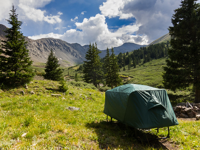
Stevens Gulch Camp by IntrepidXJ, on Flickr
My alarm woke me up bright and early at 4:00am on Saturday morning. After having a quick breakfast of oatmeal and getting my pack ready for the hike, I was on the trail at 4:30. I started the hike up Stevens Gulch under a canopy of stars with the silhouettes of the surrounding mountains just barely visible. There were a few other people on the trail at this time, but they were pretty far ahead of me, so I was by myself for a while. It was nice, especially since I knew the trail would be packed full of people in a few short hours. The stars soon faded as the dawn light arrived. As I was nearing the base of Grays and Torreys I was treated to the first light of the day striking both peaks as the sun was just rising in the east. I took a few photos of the peaks glowing orange before starting my climb up to the top of Grays Peak.
Just as the sun started to rise, it gave Torreys Peak a purplish glow for less than a minute. Luckily my camera was handy.
Early Torreys by IntrepidXJ, on Flickr
Then the mountains in front of me were bathed in amazing warm light. It was an incredible sight and made me wish I had dragged my heavy DSLR along with me. The mountain lit up in this photo is Torreys Peak.

Torreys Sunrise by IntrepidXJ, on Flickr
1 comment | posted in 14ers, Adventures, Camping, Hiking, Mountaineering, Summits, Trip Reports
Jul
3
2012
Saturday, June 30, 2012
At 14,309 feet, Uncompahgre Peak is the highest point in the San Juan Mountains and the 6th highest in Colorado. It was also our destination this morning.
After work on Friday, Jackson and I loaded up my Jeep and headed south to the San Juan’s. We made a quick stop for dinner in Montrose and then we were soon passing through Ouray and turning off the highway on the rough road following the Uncompahgre River and Mineral Creek. Next we found ourselves driving at just under 13,000 feet as we crossed Engineer Pass and dropped back down along Henson Creek. When we reached the rough road that follows Nellie Creek we turned onto it and climbed a few thousand feet again until we had reached the boundary for the Uncompahgre Wilderness area and the trailhead to Uncompahgre Peak. We quickly setup camp in what was left of the twilight and got to bed early.
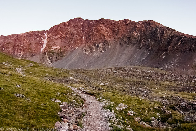
Bright and early on Saturday morning we were up and having a quick breakfast before starting the hike. As we entered the wilderness our surroundings were still in the shadows, but occasionally we would catch a glimpse of Uncompahgre Peak lit up with a golden early morning light. Next time I will have to get an earlier start so I can take a few photos of that (and also bring along my DSLR).
Uncompahgre Peak lit up with golden light on a cloudless morning.
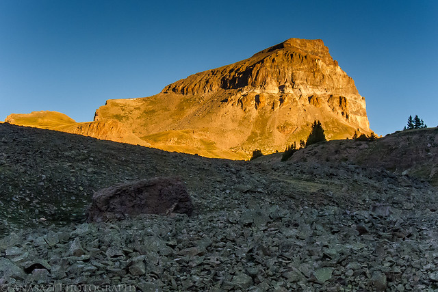
Uncompahgre Sunrise by IntrepidXJ, on Flickr
Uncompahgre Peak…that way!
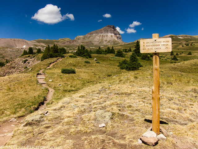
Intersection by IntrepidXJ, on Flickr
Easy trail through the alpine tundra.
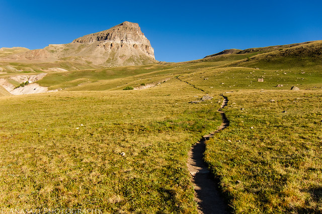
Path to Uncompahgre Peak by IntrepidXJ, on Flickr
Comments Off on Uncompahgre Peak | posted in 14ers, Adventures, Camping, Hiking, Mountaineering, Summits, Trip Reports
Aug
6
2011
Saturday, August 6, 2011
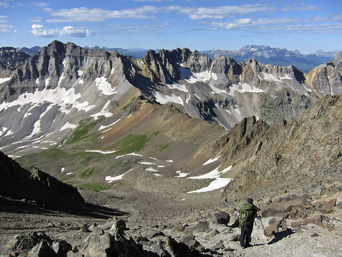
This morning I set out with my friend Jackson to climb my second 14er (after climbing Handies Peak last year). We got a very early start and drove to the upper trailhead in Yankee Boy Basin. Unfortunately, about halfway up, Jackson started not feeling so well and had to turn around. I continued on by myself to the summit (well, there were plenty of other people on the trail with me). There were a few sections that scared me a bit, but I was able to face my fears and continue to the top…..and then make it back down again. It was a beautiful day and I had a great time and am glad I was able to accomplish this goal I set for myself this year 🙂
Gilpin Peak
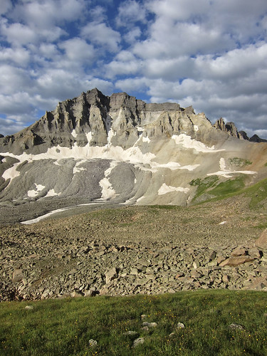
A view of Gilpin Peak from the trail in the early morning light.
Start of the Climb
An early and easy section of the trail.
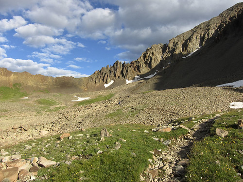
Hiking Towards the Spires
View towards Blue Lakes Pass from the trail.
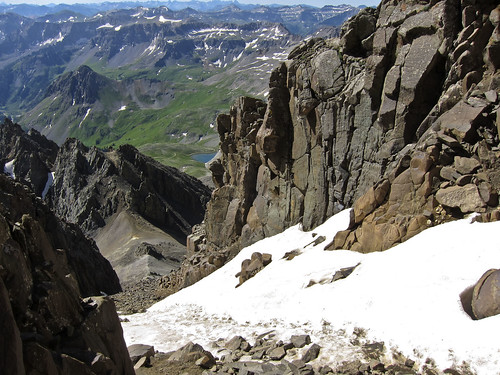
Blue Lakes Pass
Now a view down on Blue Lakes Pass from the top of the first chute I had to climb.
The Upper Chute
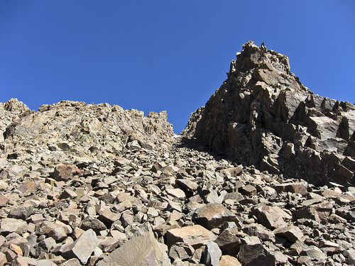
Looking up at the second chute I needed to climb up from the saddle.
Climb Through the Snow
Looking back down through the section of snow I had to climb up. It was easier than it looked to get up, but I certainly didn’t want to go back down this way. Luckily, I didn’t have to since I followed a group back down a different way.
People on the Summit
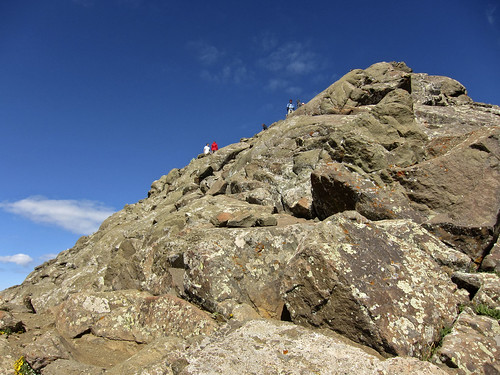
Looking up the final climb to the summit….plenty of people up there.
The Blue Lakes
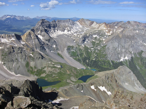
View from the summit down on the Blue Lakes.
At the Summit
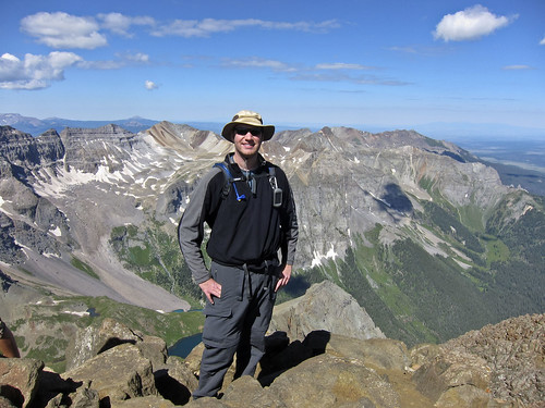
Me at the summit.
Yankee Boy Basin
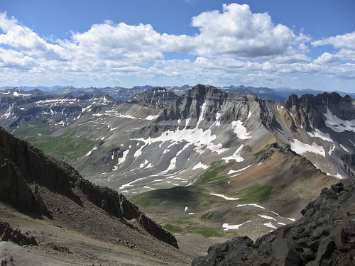
A view down into Yankee Boy Basin on my way back down.
1 comment | posted in 14ers, Adventures, Hiking, Mountaineering, Summits, Trip Reports
Sep
10
2010
This past Labor Day Weekend Amanda had to unfortunately work on Sunday and Monday, so I was on my own. I figured that I would head back to The Henry Mountains to complete some of the trails that were blocked by snow on our last trip, plus do a little hiking to the top of Mount Ellen. You can find the previous trip report here.
After some breakfast on Sunday morning I made my way to Hanksville, where I topped off of my gas tank and headed south towards The Henry Mountains.
I did a little exploring on some side roads before actually reaching the mountains.
Following the Sawmill Basin Road around Bull Mountain
…and then up to Wickiup Pass at 9,200 feet.
Nice views of the desert stretching out beyond the mountains
Continue reading
Comments Off on Laccolith Tour | The Henry Mountains Revisited | posted in Adventures, Hiking, Mountaineering, Summits, Trip Reports
Jul
12
2010
One of the goals I set for myself this year was to hike a 14er. Yesterday morning two friends and I hopped into my Jeep and headed down to the San Juan Mountains to try Handies Peak. Handies Peak is 14,048 feet high and ranked 40th out of the 53 14ers in Colorado. I chose this mountain because it’s relatively close to home, but mainly because it is one of the easier trails to the top of a 14er. From American Basin the trail is only 5.5 miles round trip with about 2500 feet of elevation gain.
Since we were in my Jeep, we headed south to Animas Forks via Silverton and headed over Cinnamon Pass to reach American Basin. We ended up starting the hike a little later than we had planned, but we did end up reaching the summit by around noon. There were a number of dark clouds forming around us when we reached the top, but luckily we only had a few sprinkles of rain fall on us during our descent. I definitely struggled a little from the saddle to the peak, but am happy to report that I did make it all the way to the top 🙂
Here’s a few photos from our climb.
Handies Peak towers above my Jeep in American Basin before we get started.
Hiking to the top
Andrew
Me.
Andrew and the trail ahead
Continue reading
Comments Off on Handies Peak | My First 14er | posted in 14ers, Adventures, Hiking, Mountaineering, Trip Reports


