Gateway – Castleton Road
Gateway – Castleton Road (Gateway, CO)
The Gateway – Castleton Road is an easy road that starts off in Gateway, Colorado and ends in Castleton, Utah near the La Sal Mountain Loop Road which you can take in either direction to get to Moab. This is an alternate backcountry route from Colorado to Moab that keeps you off the pavement and off of I-70. When the route is not blocked by snow in the winter, it is also my preferred route when I head to Moab from Grand Junction.
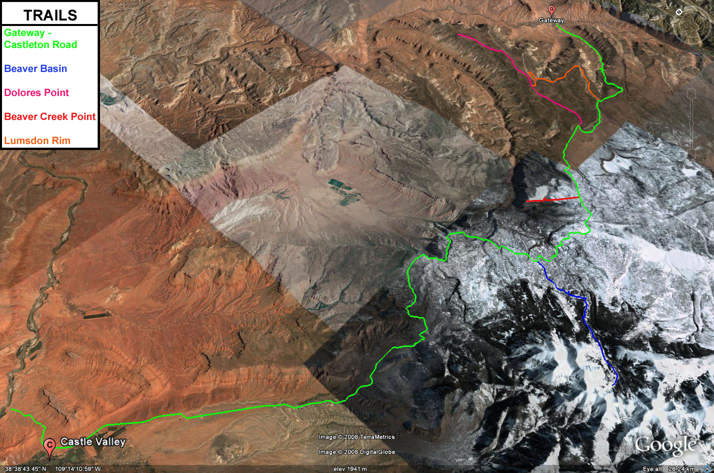
This road starts out near the Dolores River and Gateway Canyons Resort in Gateway and takes you through John Brown Canyon. This area of western Colorado is a historic uranium mining area, and now there is currently a new uranium mine that has opened up again. After leaving Colorado and entering Utah you travel through the lower foothills of the La Sal Mountains and are greeted with great views of Castle Valley and Fisher Valley.
There are a number of roads and trails all along the Gateway – Castleton Road that you can spend much time exploring. Some of these trails include Beaver Basin, Polar Mesa, Fisher Mesa, Adobe Mesa, Dolores Point and Taylor Flat. I have spent a lot of time in this area and there are still a lot of places I haven’t been to yet.
Please feel free to leave your comments and post your pictures from the Gateway – Castleton Road below.
Gateway – Castleton Road KML Track
(Right click and ‘Save Target As’)
Open file above in Google Earth.
June 17th, 2009 at 10:59 pm
[…] over the Dolores and take a right into John Brown Canyon. From this point on, you can follow the Gateway-Castleton Road to the La Sal Loop Road, which will take you to […]
June 19th, 2009 at 7:10 am
[…] Gateway-Castleton Road This route is the quickest and easiest way to get to Moab from Grand Junction. About half the route is paved and the other half is off-pavement. The start of this route follows the Unaweep/Tabeguache Scenic and Historic Byway (Colorado 141) to Gateway and then follows the Gateway-Castleton Road the rest of the way. […]
October 12th, 2010 at 7:50 pm
intersted in going. will a subaru wagon make it?
October 12th, 2010 at 8:03 pm
Unless the road gets washed out by a recent storm, it’s usually pretty well maintained (especially on the Colorado side….once you cross the border into Utah it’s a little rougher). A Subaru would have no problems driving this road.
March 24th, 2011 at 3:36 pm
What about driving conditions around March 26? Snow, water, mud?
March 24th, 2011 at 4:54 pm
Never taken that road this early in the season, but it’s been dry at the lower elevations for a while now. However, this road does get up near the La Sals, and I still saw snow on top of Fisher Mesa last weekend, so there may be some drifts or mud?
May 9th, 2012 at 9:07 pm
[…] was in 2007 in the fall with the Norco Crew. We had a short ride in Fruita and decided to drive a backroad to Moab through Gateway. It was a nice route and if you have time and its dry check it […]
September 12th, 2012 at 8:33 am
Thanks for the description! Any idea who would I contact for current road conditions CO & UT highway departments or a Forest Service district? I am planning to drive it next week. 🙂
September 13th, 2012 at 7:06 am
Your best bet would probably be the Grand Junction and Moab BLM offices. The Colorado side is usually in better condition than the Utah side since there is some mining activity in Colorado in that area. This time of the year the road should be in decent shape as long as you have a high clearance vehicle.
September 13th, 2012 at 7:18 am
Thanks, Randy! I didn’t know if the recent rains might have damaged it but it sounds like a road that is in decent shape. I am running a 2011 JKU with a 2.5″ lift so I should be good! 🙂 Thanks, again!