Jun 3 2012

Bridgeport to Whitewater

Saturday, May 12, 2012

Over the winter I bought my own inflatable kayak so that I wouldn’t have to rent or borrow one anymore, and I’ve been looking forward to getting it on the river for the first time this year. Originally, Jackson and I wanted to go on a day trip through Ruby-Horsethief Canyon on the Colorado River, but because of the low river this year, we knew that it would not work very well as a day trip. Instead we decided to check out a new section of the Gunnison River that is very close to home.

We dropped off my Jeep at at boat ramp in Whitewater and then took Jackson’s car up to Bridgeport where we would get on the river. We knew this section of the river was going to be pretty flat, but it was much slower than we thought it would be. We ended up having to paddle much of the way to keep moving at a reasonable pace. Luckily, it wasn’t that windy today or it could have been much slower!

My new Tributary Tomcat Tandem ready for it’s maiden voyage down the Gunnison.


Ready to Launch by IntrepidXJ, on Flickr

Jackson and the rest of his family on the river.


Jackson & Family by IntrepidXJ, on Flickr

Nice view down the river.


Paddle by IntrepidXJ, on Flickr


May 24 2012

The Needles & Indian Creek

Sunday, May 6, 2012

After a nice night sleeping along Indian Creek, I was awake again the break of dawn and having some breakfast. I packed up camp and then headed back into The Needles for another day of exploring. I was soon driving the rough road over Elephant Hill into the heart of the Needles. I ended up doing a little hiking and searching for some new rock art sites as I explored this beautiful area once again.

Driving through Elephant Canyon after crossing over Elephant Hill.


Elephant Canyon by IntrepidXJ, on Flickr

Squeezing my Jeep through this tight section into Devil’s Pocket.


Devil’s Pocket by IntrepidXJ, on Flickr

Interesting black handprints along the road.


Black Hands by IntrepidXJ, on Flickr

Great view in Devil’s Lane.


Devil’s Lane by IntrepidXJ, on Flickr


May 23 2012

Lost Canyon & Squaw Canyon Loop

Saturday, May 5, 2012

On Saturday morning I set out early to drive down to The Needles District of Canyonlands National Park. One of my goals for 2012 was to spend more time hiking and exploring in this amazing area. Unfortunately, because of circumstances earlier this year I was unable to make it down here until now, so I’m getting a later start than I had originally planned. Better late than never, I guess. I’ve still got plenty of time this year to return a few more times 😉

When I made it to the park I headed straight for the Squaw Flat Campground and started hiking the Lost Canyon and Squaw Canyon loop trail. It was a beautiful morning that was perfect for hiking. I made it to Lost Canyon in no time.

The well-used trail to Squaw Canyon, Lost Canyon and eventually Peekaboo.


Trail Ahead by IntrepidXJ, on Flickr

Crossing the sandstone of the Squaw – Lost Canyon Divide


Lost Canyon Divide by IntrepidXJ, on Flickr

Following the cairns.


Lost Canyon Trail by IntrepidXJ, on Flickr


May 16 2012

Backpacking Big Dominguez Canyon

Saturday & Sunday, April 28-29, 2012

I’m proud to say that I have finally gone on my very first backpacking trip. I’ve been collecting gear for the past few months and finally scheduled a trip with my friend Jackson and his dad. Since this was my first time, I wanted to keep the trip shorter and closer to home…kind of like a trial run to see how it all went. I’m happy to report that everything went well, and I’m looking forward to my next backpacking trip in the future.

Overall, I think I made some good choices when I was selecting gear over the past few months, but I’m sure I’ll be making some changes here and there to try and get the weight down further. With my pack loaded up with camping gear, food, water and camera gear, I was carrying just under 40lbs (with my camera around my neck, the weight on my back dropped to 35lbs). I’d like to get that number closer to 30lbs in the future, but it’s probably going to take some trial and error.

Since I was looking for a destination close to home and with not too long of a hike, we settled on Big Dominguez Canyon. It’s only about 20 miles from my house and was supposed to be about 7 miles in length. I have day-hiked the canyon from Bridgeport a few times before, but never gone more than a few miles in. This time we would be starting from the Cactus Park trailhead and descending down the canyon to Bridgeport.

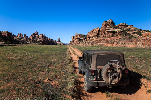
After dropping off a truck at Bridgeport on Saturday morning, we loaded up my Jeep and drove up to Cactus Park. We were expecting to be able to drive to the rim of Dominguez Canyon and then hike down into the canyon, but that’s not quite how it worked out. What we found was a pretty new gate across the road about two miles from the canyon. Apparently, when this area became an official wilderness back in 2009, they must have extended the boundaries or removed the cherry-stem for this road and closed it. So, right from the start our planned hike was going to be two miles longer. We got our packs on our backs and started hiking down the closed road.

An old sign indicating the way to Dominguez Canyon found along the old closed road. The Wilderness Study Area sign is a bit outdated since this area is officially a Wilderness now.


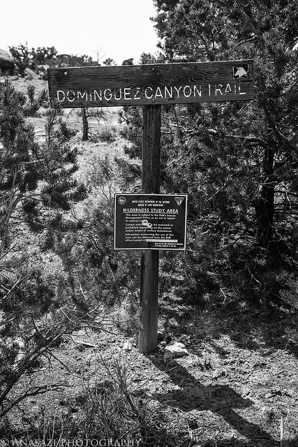
Dominguez Canyon Trail by IntrepidXJ, on Flickr

Jackson and his dad are birders, so they frequently stopped to find and identify birds they heard along the way.


Bird Watching by IntrepidXJ, on Flickr

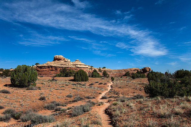
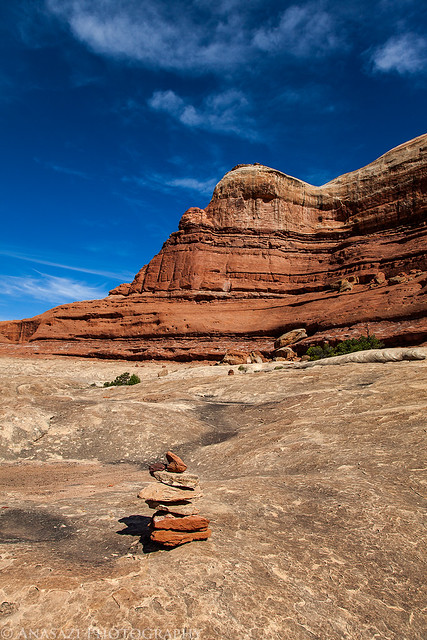
When we finally reached the rim, we had a difficult time locating the trail down into the canyon. We ended up walking the rim looking for a way down the wrong way at first and then had to retrace our path and hike the other way. We did finally manage to find the steep route into the canyon, but it ended up adding a few more miles to our hike.

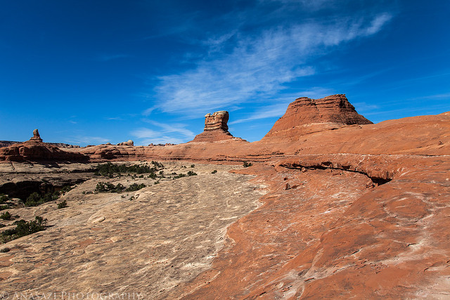
A great view from the rim of the canyon with Triangle Mesa and the Grand Mesa in the distance.


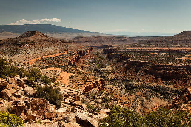
Big Dominguez Canyon & Triangle Mesa by IntrepidXJ, on Flickr

Jackson’s dad on the rim of the canyon as we tried to figure out the way down.


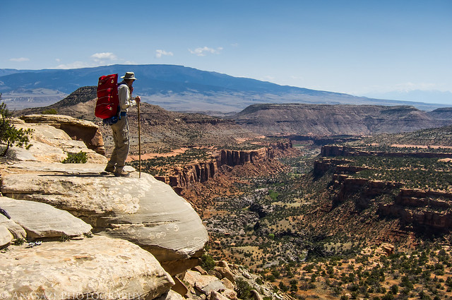
On the Edge by IntrepidXJ, on Flickr


May 10 2012

Cedar Mesa & Bluff

Saturday & Sunday, April 21-22, 2012

I was originally supposed to go camping this weekend with Amanda, but at the last minute she was unable to go with me, so I had to figure out something else to do. I sent an email to Marty to see if he was free on the weekend for some hiking on Cedar Mesa, but I figured he already had plans and I would be on my own. To my surprise, he was free and willing to join me. At first he thought he would only be joining me on Saturday, but he ended up camping overnight and exploring with me the whole weekend.

We met up in Blanding at the usual gas station so that we could top off our fuel tanks before driving through Comb Ridge and up onto Cedar Mesa. We made a quick stop at the Kane Gulch Ranger Station so that I could finally grab my Annual Hiking Permit for the year, and then continued on to the Owl Creek Canyon trailhead. I was surprised to see so many vehicles parked here. I guess I am used to hiking the lesser travelled canyons in Cedar Mesa, because I wasn’t expecting the parking area to be packed. Normally I would probably turn around and find somewhere else to go, but I sucked it up and continued on down into Owl Canyon for a short hike.

We stopped and visited the well-preserved set of ruins just in the large alcove along the trail. There were some very interesting and unique ruins here.


Owl Creek Alcove by IntrepidXJ, on Flickr

There were also some pictographs painted on the ceiling of the alcove.


Paintings by IntrepidXJ, on Flickr


Small Room by IntrepidXJ, on Flickr