Nov
26
2012
Thursday – Sunday, November 1-4, 2012
After work on Thursday evening I got in my Jeep and drove into Utah again. I had taken Friday off from work and was planning on meeting a group of friends in Beef Basin for a long weekend of camping and exploring the area. A few months earlier my friend Rob had tipped me off about a large petroglyph panel in the area he knew I would be interested in finding, and that was the beginning of planning for this trip. I arrived at our predetermined campsite in the dark and found Marty already there with his tent setup and a campfire already going. I was surprised to only be the second person there but knew the others would arrive shortly. Twenty minutes later Alex, Rob and his companions showed up. We sat around the fire for a little while waiting for the others, but headed to bed before anyone else arrived since we planned an early start for the following day. As soon as we were in our sleeping bags Jared and his brother Brian showed up. Later that night I heard Dave and his son pull up in their Jeep. We had all made it.
Friday morning I was up early and it looked like there might be a good sunrise, so I got in my Jeep to find a place to take some photos and ended up at a nearby ruin. I was hoping the sky would light up with color, but only the horizon turned a little pink.
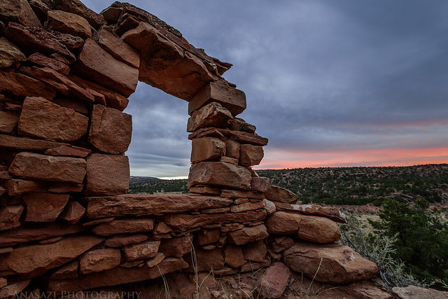
Open Window by IntrepidXJ, on Flickr
After returning to camp and waiting for everyone else to finish getting ready we got in our vehicles and drove over to the Fable Valley Trailhead. We were planning on exploring Gypsum Canyon following a route that Rob had planned out.
We started out hiking along an old closed road that followed the rim of the canyon. This is looking back at the confluence of the two upper forks of Gypsum Canyon.
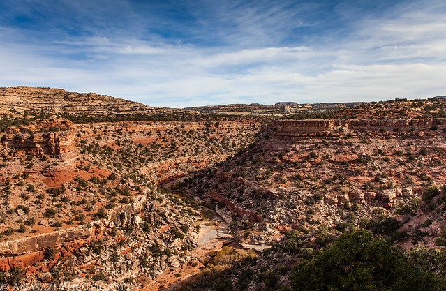
Gypsum Fork by IntrepidXJ, on Flickr
Once the old road ended we were left scrambling and route-finding our way along the rim of the canyon and then across a small side canyon.
Looking down the canyon towards the confluence with Fable Valley from the rock we stopped at for a lunch break.
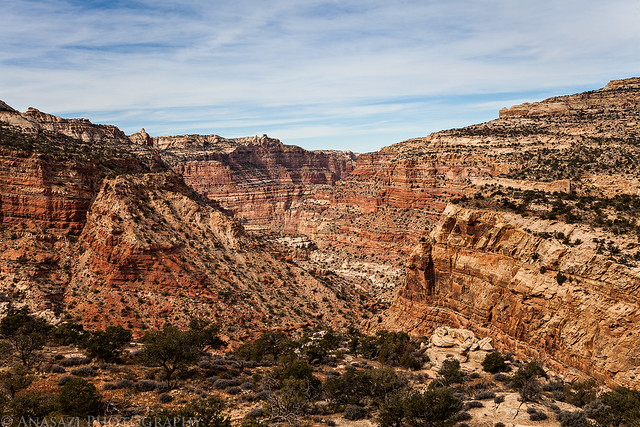
Down Canyon by IntrepidXJ, on Flickr
1 comment | posted in Adventures, Anasazi, Camping, Canyoneering, Hiking, Photography, Rock Art, Trip Reports
Nov
6
2012
Arizona Strip & Southern Utah Wanderings | Day 8
Saturday, October 13, 2012
It rained again on Friday night. Not near as much as the previous night, but enough to make everything wet when we took down camp in the morning. Once we got our camp packed up into the Jeep and had a little breakfast, we drove over to the Bullet Canyon trailhead so we could start our hike for the day. Our main destinations for today would be Perfect Kiva and Jailhouse Ruin, but we would explore the canyon along the way, too.
About seven miles to Grand Gulch from here, but we weren’t planning on going that far this time. I’m definitely going to have to check out the full canyon on a future backpacking trip.
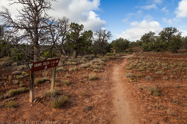
To Grand Gulch by IntrepidXJ, on Flickr
Shortly after descending into Bullet Canyon from the rim, Jared spotted these pictographs.
White Pictographs by IntrepidXJ, on Flickr
We also passed the remains of a tower up on the rim of the canyon.
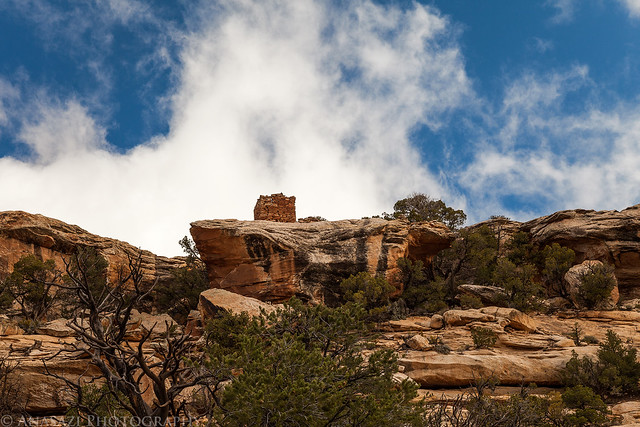
Rim Tower by IntrepidXJ, on Flickr
Comments Off on Bullet Canyon | posted in Adventures, Anasazi, Camping, Hiking, Photography, Rock Art, Trip Reports
Nov
4
2012
Arizona Strip & Southern Utah Wanderings | Day 7
Friday, October 12, 2012
Sometime after midnight the skies finally opened up and it started raining. There was a little lightning and thunder, too. It would rain harder and softer but remained pretty constant for the rest of the night. Around the time we wanted to get up in the morning it started to rain the hardest yet, with a few close lighting strikes. We waited in our dry tents for the storm to let up so that we could finally get outside.
When the rain finally stopped for a short time I got out of my tent and snapped this photo. There was a small wash next to our tents that was flowing pretty good. We were high enough that it didn’t affect us.
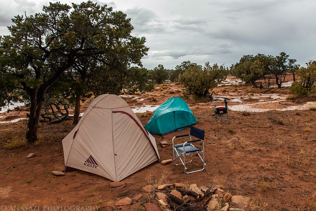
Wet Camp by IntrepidXJ, on Flickr
Shortly after we got out of our tents, this rainbow appeared across the desert.
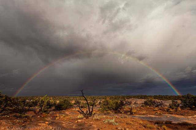
Desert Rainbow by IntrepidXJ, on Flickr
Our original plan for the day was to hike the Slickhorn Canyon #1 and #2 loop, but I wasn’t up for hiking the loop in the pouring rain and neither was Jared. We could see more storms approaching, so we decided to drive over to the top of the Moki Dugway so I could get some cell signal and check the weather forecast.
While driving back to the highway we spotted a small double rainbow in the distance.
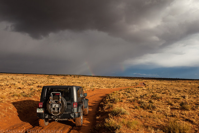
Rainbows & Jeep by IntrepidXJ, on Flickr
Comments Off on Slickhorn Perfect Kiva | posted in Adventures, Anasazi, Camping, Hiking, Photography, Trip Reports
Nov
1
2012
Arizona Strip & Southern Utah Wanderings | Day 6
Thursday, October 11, 2012
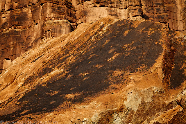
After sleeping in a little later on Thursday morning, we had a little breakfast and hiked down the old road past the washout in search of rock art. After looking at the washout closely, I’m pretty sure I could have driven my Jeep across if I really wanted to, but we were more interested in hiking today, so that’s what we did. We managed to find plenty of petroglyphs on the scattered boulders along the way, some were better that others, but they were all fun to discover as we hiked.
This large boulder had a few footprints pecked into the top of it like tracks.
Footprints by IntrepidXJ, on Flickr
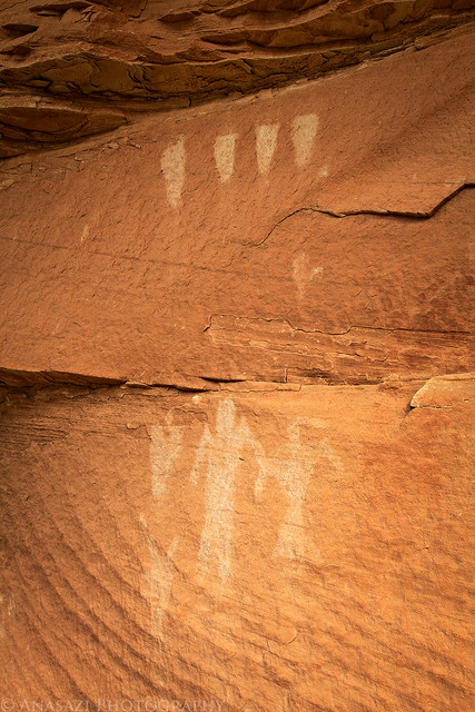
This was one of the better petroglyph panels we found.
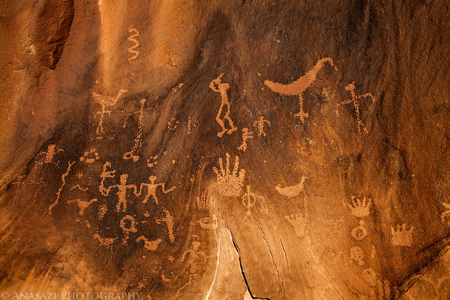
Hands by IntrepidXJ, on Flickr
Two atlatls and another duckheaded man.
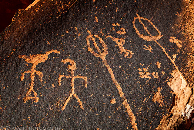
Atlatl Boulder by IntrepidXJ, on Flickr
Comments Off on Rock Art Road | posted in Adventures, Anasazi, Camping, Hiking, Photography, Rock Art, Trip Reports
Oct
30
2012
Arizona Strip & Southern Utah Wanderings | Day 5
Wednesday, October 10, 2012
On Wednesday morning, after a great night sleeping under the stars on Alstrom Point, we woke up just as dawn was starting to break. I rolled out of my sleeping bag, grabbed my camera and walked a few feet to the edge of the cliff overlooking Lake Powell. Looking towards the sky to the east I had a feeling that there was going to be a great sunrise.
My campsite for the night as the sky begins to light up. I’ve had a lot of questions about my tentcot in the past, and another great feature of it is that I can use it as just a regular cot, too.
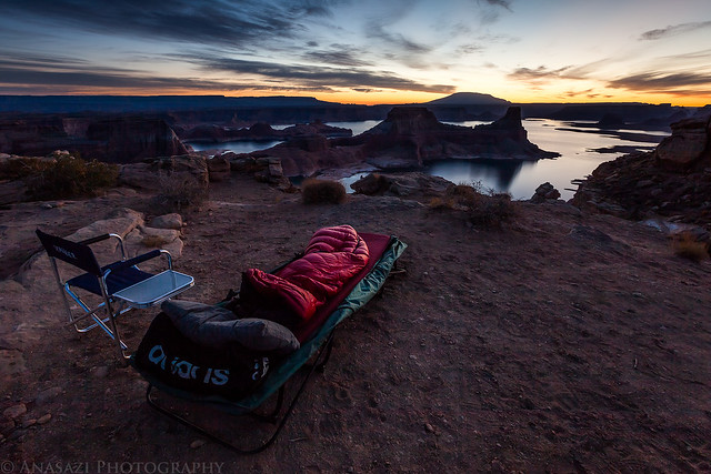
Morning View by IntrepidXJ, on Flickr
Lake Powell and the cliffs in the distance as the sky above turns pink.
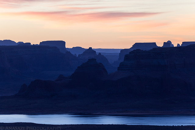
Warm & Cool by IntrepidXJ, on Flickr
Right before the sun came up, the sky exploded with color! One of the best sunrises I have witnessed.
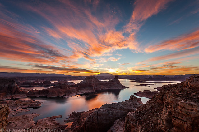
Alstrom Point Sunrise by IntrepidXJ, on Flickr
Comments Off on Alstrom Point to Johns Canyon | posted in Adventures, Anasazi, Camping, Hiking, Photography, Rock Art, Trip Reports, Ute