Sheep Creek Route (Grand Junction to Moab)
Sheep Creek 4×4 Route
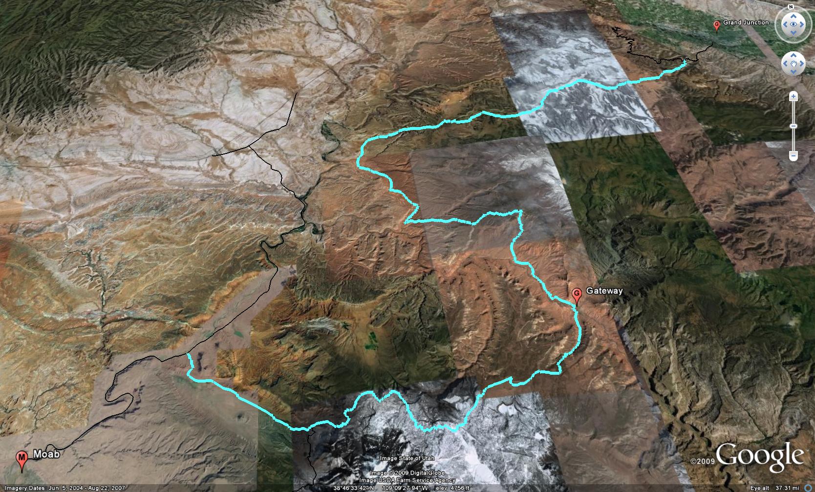
There are a couple of possible routes to get from Grand Junction to Moab by staying off of the highway. I know a number of people are interested in taking Ds Road out of Grand Junction and across the Dolores Triangle to end up on Entrada Bluffs Road near the Dewey Bridge. While this is an excellent route between GJ and Moab, there is one huge problem with it; the crossing of the Dolores River is usually not crossable by most vehicles until later in the year. That means if you are heading to Moab in the spring or early summer, chances are that it is not a viable route for you.
There is another option that will take you across part of the Dolores Triangle, though. I call this the Sheep Creek Route. This route starts out the same way, by following Ds Road out of GJ and onto the Dolores Triangle. However, instead of taking the right turn towards the Dolores River ford, you will take the left fork and head towards Granite Creek. After dropping down to the Granite Creek crossing and then climbing back up the other side, this road will get narrow and rocky. It will be slower going from this point and hopefully you aren’t too concerned about your paint job, as the brush on this trail does get up close and personal to your vehicle.
After a right turn off of this trail comes the fun part. Descending the Sheep Creek switchbacks to Gateway. This section of trail is very steep and has a number of pretty tight switchbacks at the top. It is also prone to washing out, so you might want to check with the Grand Junction BLM office (970- 244-3000) before heading out this way. As a matter of fact, the switchbacks were just recently repaired by the BLM (May 2009) after having been washed out since the end of last summer (2008).
Once you reach the bottom of the Sheep Creek switchbacks, you will soon meet up and then parallel the Dolores River for a few miles to Gateway, CO. Back in Gateway you can stop and fuel up or grab a snack if needed. Cross the bridge over the Dolores and take a right into John Brown Canyon. From this point on, you can follow the Gateway-Castleton Road to the La Sal Loop Road, which will take you to Moab.
GPS Tracks for the Sheep Creek Route
![]() Google Earth Track (Version 1)
Google Earth Track (Version 1)
![]() GPX Track (Version 1)
GPX Track (Version 1)
If you have any questions, suggestions or comments about the Sheep Creek Route from Grand Junction to Moab, please feel free to post them below.
This page was last updated on: 12/19/2009