Dec 7 2011

Veterans Day Weekend at Natural Bridges

November Cedar Mesa & Comb Ridge Trip 2011
Friday & Saturday, November 11-12, 2011

Right after an awesome three day weekend in Northern Arizona I was headed down to Cedar Mesa with my friend Jackson for another long weekend over Veterans Day weekend. Our destination and goal for this trip was to explore Natural Bridges National Monument for two days. I had been to the park once before, but at that time we only stayed up on the canyon rim and viewed the bridges from their respective overlooks. This trip we were planning on descending down into White Canyon so that we could begin to explore the area for the abundent ruins and rock art found within the park. This was just the first of many trips I plan to spend exploring the area!

One of the main pictographs I was looking for on this trip was the White Man. We managed to find that one first.


White Man Alcove by IntrepidXJ, on Flickr

There’s a few other interesting white pictographs next to it, including a large T-shaped design.


White Pictographs by IntrepidXJ, on Flickr

The White Man is larger than it might look in the photos above. Here’s Jackson standing next to it for scale.


Jackson and the White Man by IntrepidXJ, on Flickr


Dec 1 2011

The Wave Weekend

Friday-Sunday, November 4-6, 2011

The Wave, located just south of the Utah-Arizona state line in the Vermilion Cliffs Wilderness Area, is one of those places that every photographer and hiker wants to visit. It’s hard to blame them because it is such a unique and amazing area. Unfortunately, because of it’s popularity, the BLM has a permit system in place that allows only twenty people per day the chance to experience this remarkable area. If you’ve read my blog for any length of time you might know that I am averse towards any kind of permit when I go out exploring, so in the past I have usually avoided those places. This year I have made an effort to finally visit some of those places that require a permit, including The Maze and the White Rim. A few months ago I decided that I would try to get a permit so that I could hopefully visit The Wave this year, too. Since there are only 20 permits per day, it can be difficult to obtain one. For anyone not familiar with the Coyote Buttes North permit system, ten of the permits for each day are awarded in a lottery three months in advance and the other ten are distributed in person the day before. I guess I was pretty lucky since I managed to snag two permits in advance on my first try. Once I had my permits, Amanda and I decided to make a long three day weekend out of the trip.

We left early on Friday morning and drove down through Monument Valley since Amanda hadn’t been through there before. Shortly after passing through Kayenta we turned off the main highway so we could make a quick visit to Navajo National Monument. We took the short Sandal Trail to on overlook of the Betatakin Ruins. The viewpoint was still pretty far away from the large alcove containing the ruins so I’m glad I had my long lens with me. We were lucky that most of the ruins were all in the sunlight, so I didn’t have to deal with a large shadow in part of the scene.


Navajo National Monument by IntrepidXJ, on Flickr

This huge alcove contains the Betatakin Ruins.


Betatakin Alcove by IntrepidXJ, on Flickr

A closer look at the ruins found here.


Betatakin Ruins by IntrepidXJ, on Flickr

Here’s a view of the large alcove in it’s canyon setting for a little better sense of scale.


Betatakin Overlook by IntrepidXJ, on Flickr


Oct 21 2011

Late Hike in a Deep Canyon

Arizona Strip & Southern Utah Wanderings | Day 3
Monday, October 3, 2011

After a good night of sleep, we woke up on Monday morning early enough so that we could drive back over to the overlook at Toroweap and catch the sunrise. We set up our cameras at a viewpoint overlooking the Grand Canyon to the East.

The sun just peeking over the horizon with a great view down into the Grand Canyon.


Sun-Kissed Canyon by IntrepidXJ, on Flickr

After taking some photos looking East, Jared and I headed over to get a view towards the West.


Jared at Toroweap by IntrepidXJ, on Flickr

Jared taking his shot.


Taking the Shot by IntrepidXJ, on Flickr

Once we were done photographing the sunrise, we packed up camp and left Toroweap behind.


Leaving Toroweap by IntrepidXJ, on Flickr


Oct 19 2011

Straddling the Border to Toroweap

Arizona Strip & Southern Utah Wanderings | Day 2
Sunday, October 2, 2011

After an awesome night camping under the stars in perfect weather near Little Black Mountain, we were up early, had a little breakfast and were soon on our way back into Utah. Our ultimate destination for the day would be Toroweap on the North Rim of the Grand Canyon, but we would have a lot of exploring to do on our way there.

After entering Utah again, we quickly found ourselves in Warner Valley. As we headed east, we took the short detour to Fort Pearce which is located along the old Honeymoon Trail.


Fort Pearce Heritage Site by IntrepidXJ, on Flickr

Of course, our first objective at the site was to find the petroglyphs located near the fort. They were easy to find and the area offered a nice view.


Fort Pearce Petroglyphs by IntrepidXJ, on Flickr

A closer look at the petroglyphs on the slanted boulder.


Fort Pearce Boulder by IntrepidXJ, on Flickr


Jan 27 2011

Cave 7

Sunday, January 23, 2011


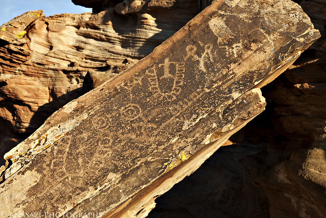
Ninety-seven skeletons were taken from this cave. Many of the men showed evidences of having been killed, as spearpoints were found between the ribs and arrowpoints in the backbones. One case where the hip bones were pinned together wtih a huge obsidian spearpoint shows that no small amount of force was used to bury a point of that size into two inches of bone.

– Richard Wetherill, 1896


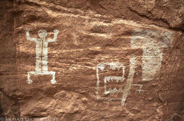
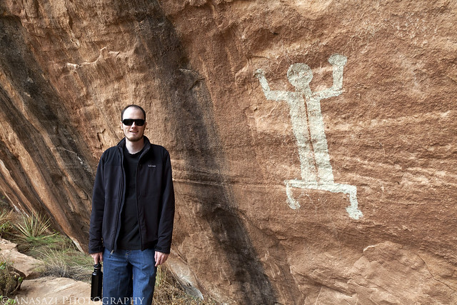
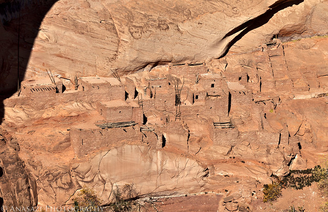
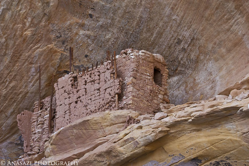
Pastel Alcove Ruin, near Cave 7
Pastel Alcove Ruin

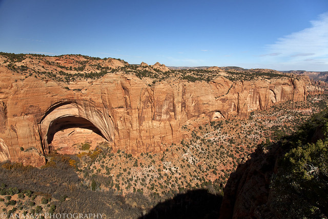
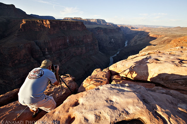
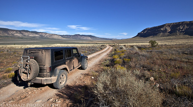
On Saturday while I was in Moab, I got a message from my friend Rick. He wanted to get out of the house on Sunday and wanted to know if I wanted to tag along. He told me that he was interested in visiting Cave 7 in the winter, so I jumped at the opportunity and told him I would definitely go with! Bright and early on Sunday morning I picked him up and headed towards Blanding, topped off the fuel tank and made our way to Cave 7.

*      *      *

On November 29, 1893, Richard Wetherill led the Hyde Exploring Expedition out of Mancos, CO on their way to Grand Gulch. After a stop in Bluff, UT for supplies they headed north on December 11. In a letter written six days later, addressed from “First Valley Cottonwood Creek 30 miles North Bluff City,” Richard Wetherill wrote:

Our success has surpassed all expectations….In the cave we are now working we have taken 28 skeletons and two more in sight and curious to tell, and a thing that will surprise the archaeologists of the country is the fact of our finding them at a depth of five and six feet in a cave in which there are cliff dwellings and we find the bodies under the ruins, three feet below any cliff dweller sign. They are a different race from anything I have ever seen. They had feather cloth and baskets, no pottery–six of the bodies had stone spear heads in them.

*      *      *

Cave 7 Ruin
Cave 7 Ruin

Most of what we know about the route the Hyde Exploring Expedition took and which alcoves they explored is because of the Weatherhill–Grand Gulch Research Project using reverse archeology to figure it out. Some of the alcoves in the area still have legible historic inscriptions that are dated and were used to help retrace the route they took. At the time of the Basketmaker Symposium in May 1990 the location of Cave 7 was still unknown, but by the end of May the team was close to locating it. The final piece of the puzzle that helped them actually find it didn’t fall into place until three months later when they received some new photographs from the Wetherill expeditions from the Museum of Anthropology and Archeology of the University of Pennsylvania. Using those photos and the information of the route they had already figure out, they were finally able to re-located Cave 7 again in September of 1990….almost a century after Richard Wetherill had made his Basketmaker discovery there.

*      *      *

After driving to the proper drainage and hiking over a mile through snow, mud and frozen creek crossings we soon reached the box canyon that contained Cave 7. We started out by hiking to the end of the canyon and taking some photos of Box Canyon Ruin (Pastel Alcove Ruin). This was an interesting ruin perched high up in an alcove with part of an outer wall still standing next to it. This ruin was briefly mentioned by Richard Wetherill in some of his notes, and helped verify that this small box canyon was the correct location of Cave 7.
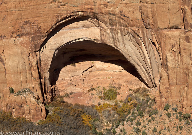
Box Canyon Ruin

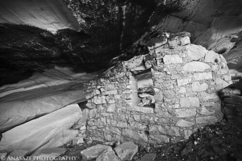
After spending some time at the ruin, we headed back and climbed up to Cave 7. There wasn’t much here, aside from one small wall, but the historical aspect of this site was certainly enough for me.

Cave 7

The line of boulders on the floor had not fallen yet in the photos I have seen from the late 1800’s and even from the Wetherill–Grand Gulch team in the early 1990s.

The remaining wall in Cave 7

This small ruin is right above Cave 7 in a smaller alcove

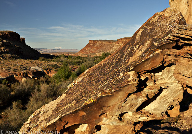
Before heading back we climbed up the slickrock on the other side of the canyon to a few alcoves. One of the shallow alcoves was lined with metate grooves

After we finished exploring around Cave 7 and looking for historic inscriptions we started our hike back to the Jeep in the snow. The drive back to the pavement was a bit slick with all the melting snow, but we made it out fine. It was a long drive for a day-trip, but well worth it. We even managed to make it home before dark.


If you are interested in finding out more about the Rediscovery of Cave 7 and Basketmaker Archeology, I highly recommend the book Cowboys & Cave Dwellers by Fred Blackburn and Ray Williamson.