Beaver Basin
 Beaver Basin (Moab, UT)
The Beaver Basin trail leaves the Castleton-Gateway Road on the northern side of the La Sal Mountains and then climbs up into a small alpine basin between two rugged peaks. Exploring this area during the summer months is a great way to beat the heat in Moab and check out an area not as popular and well travelled as some others in the area.
The lower portion of the trail is wide and graded and very easy. However, the higher you climb into the La Sals, the narrower and rockier the trail becomes. There are a few areas where passing another vehicle can be an issue and backing up a little ways might be required. Most stock 4×4’s with good ground clearance should have no problems navigating this trail.
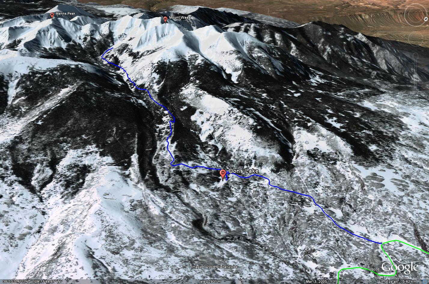
As you climb into the La Sals there is a short spur trail that leads to Dons Lake, a small lake that offers some picturesque views with the La Sals in the background. Before the final stretch of trail to Beaver Basin, there are remnants of an old cabin on the left side of the trail. There are also a number of campsites that range from small and secluded to large group sites located along this trail. While Beaver Basin might seem to be a great place to camp at first, when I was there, there were a number of cattle grazing in the basin.
This trail is only open and passable only during the late summer through the fall months due to it’s elevation.
Please feel free to leave your comments and post your pictures from Beaver Basin below.
![]() Beaver Basin KML Track
Beaver Basin KML Track
(Right click and ‘Save Target As’)
Open file above in Google Earth.