Hancock Pass
 Hancock Pass (Buena Vista, CO)
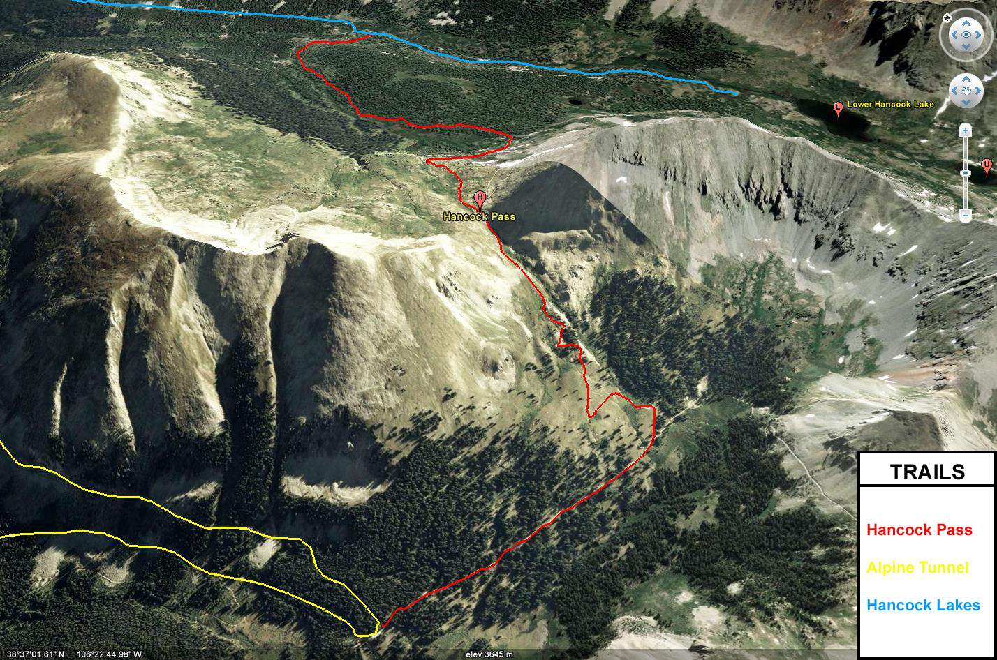
Hancock Pass takes off from the Hancock Lakes trail and crosses the Continental Divide at an elevation of 12,140 feet and connects to both Tomichi Pass and the Alpine Tunnel Road. The trail gets a bit rocky and bumpy but can be driven in a stock high-clearance 4×4 vehicle. If you start out on Hancock Lakes Road, this trail takes off from the right side shortly after passing through the Hancock townsite.
The trail is rocky as it wanders through a forest before it turns into a rocky shelf road where it climbs up to the pass. Before reaching the pass, there are some great views below. After crossing Hancock Pass, the views down into Brittle Silver Basin are awesome and is a great place for taking some photos. After following the trail down into the basin it soon meets up with Tomichi Pass and the Alpine Tunnel Road.
This trail combined with Hancock Lakes Road, Alpine Tunnel Road, Cumberland Pass and Tincup Pass makes a great loop for exploring this area of the Sawatch Range with a lot of mining history to see and explore. However, if you are looking for a quick way back to the pavement after heading over Hancock Pass, you can head over Tomichi Pass to get back to US 50.
Please feel free to leave your comments and post your pictures from Hancock Pass below.
![]() Hancock Pass KML Track
Hancock Pass KML Track
(Right click and ‘Save Target As’)
Open file above in Google Earth.